
what is drone mapping??

elevate your productivity with drone mapping.
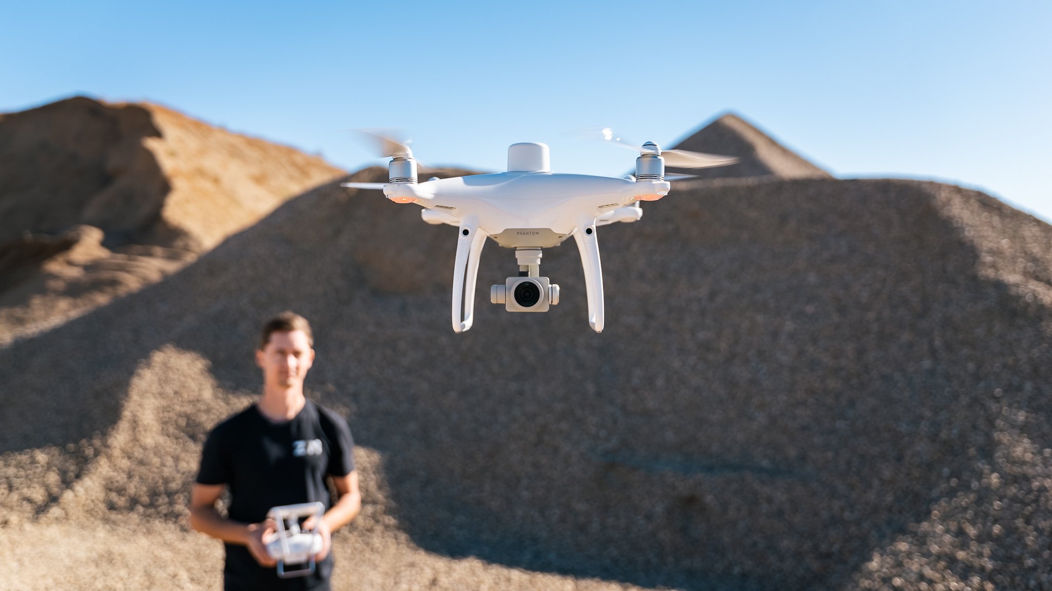
In recent years, Drone Mapping (drone surveying), has become more popular and is used to map out areas for development. These mapping projects use aerial surveys conducted by a skilled and certified pilot who flies a drone above the work site while recording images with specialist cameras that can include RGB (for photogrammetry), multispectral sensors, thermal or LiDAR devices.
Using drone mapping services can dramatically increase the accuracy of site measurements, minimize human error, accelerate delivery time and most importantly reduce cost that traditional surveyors cannot do!
WHAT TYPE OF SITES CAN DRONES SURVEY? SCROLL DOWN TO SEE.
The reason being that drones are becoming increasingly popular as they can provide us with data that would otherwise take hours or days to collect manually. For example, one study found drone mapping is capable of collecting and analyzing information 90% faster than traditional methods such map reading techniques alone! This means there is no need for multiple survey employees walking over potentially dangerous terrain to gather your survey information.
get results faster
OTHER BENEFITS
1. LOWER COSTS
Drones revolutionize construction project management, cutting survey time from weeks to days with precise data. Save on labour costs and accelerate progress without compromising quality.
2. On site work is uninterrupted.
Traditional surveys require site clearance for safety. Drones enable remote surveying, enhancing safety and efficiency by allowing normal work operations to continue.
3. Reduce human ERROR
Traditional surveys require multiple surveyors, heightening the risk of human error. Drones, with only one operator, minimize errors, ensuring safer, efficient surveys.
4. NO AREA IS TOO DIFFICULT FOR A DRONE
Traditional methods struggle with steep or hazardous terrain, leaving areas unreachable. Drones safely access these areas, enhancing safety, efficiency, and cost-effectiveness.

What type of sites can drones survey?
1. Construction surveys

Drones are versatile pre-construction tools, offering precise site data and aiding safety measures like plot demarcation and land suitability assessment. Digital overlays enable real-time project monitoring, enhancing workplace safety and efficiency by identifying hazards beforehand. Also, drones facilitate inventory management through remote volumetric measurements.
2. Oil and gas surveys

Drones aid energy companies in pipeline planning, conducting surveys to prevent disruptions and accidents. Images captured assist in identifying restricted areas and assessing natural resources swiftly, ensuring accurate placement and minimizing environmental impact and property disturbances.
3. Agricultural surveys

Drones revolutionize agriculture with swift crop damage reports, precise stand counts, and real-time plant health analysis. They replace traditional scouting methods, providing comprehensive aerial data in hours, enabling informed decisions, and offering actionable insights to manage crops effectively, minimizing losses and maximizing yields.
4. Mining operation surveys
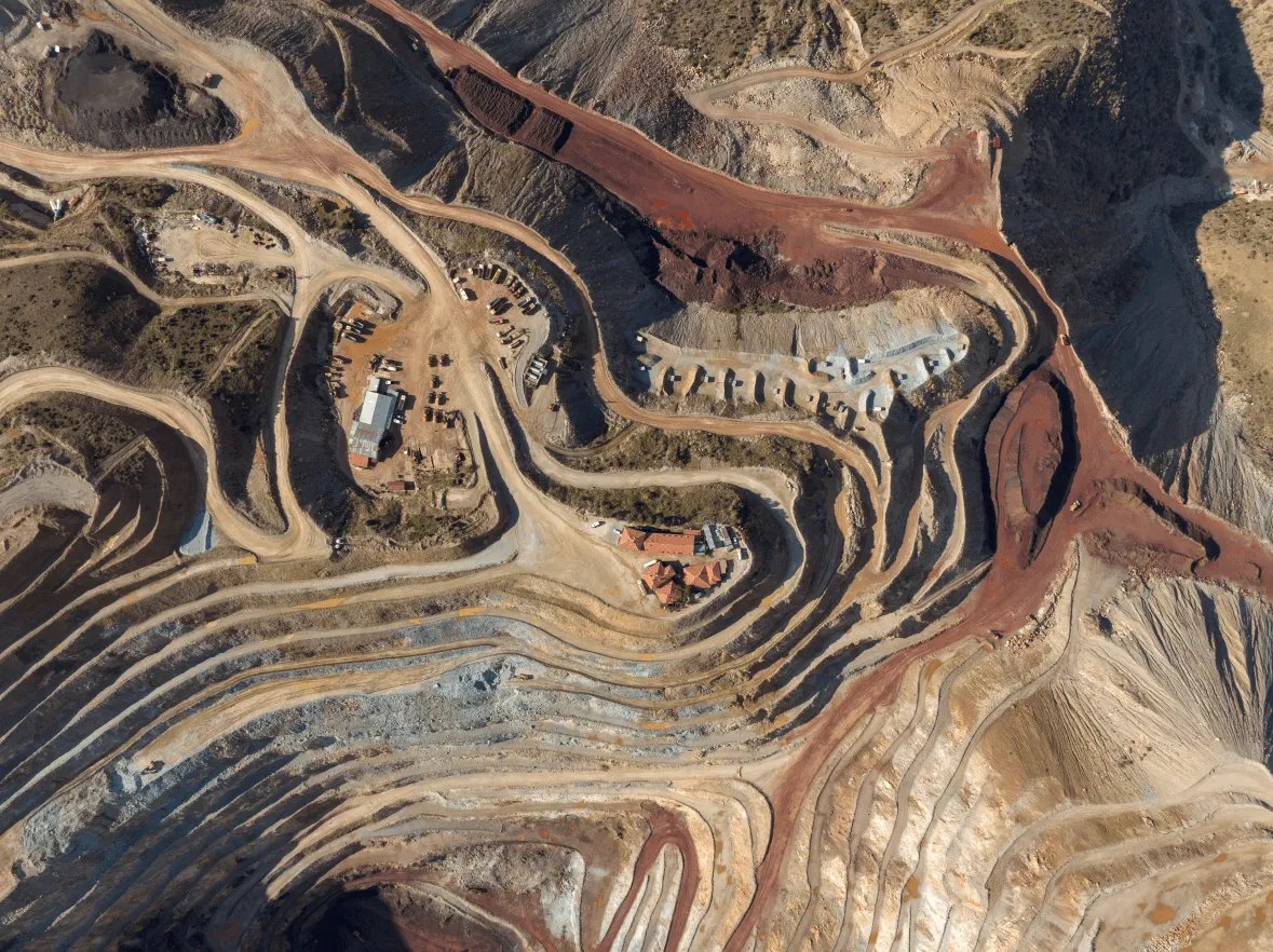
Drones excel in surveying open mines and quarries, offering rapid, precise data. Aerial photography coupled with 3D modeling software enables swift responses, surpassing traditional manual ground surveys. Their efficiency allows for data acquisition in days instead of months, making drones highly valuable for mining and quarry operations.
5. Infrastructure surveys

Drone technology aids engineers in collecting precise ground-level data crucial for designing infrastructure like roads and bridges. It's also instrumental in hydrology studies, facilitating urban planning. The accuracy and efficiency of drones streamline design processes, enhancing the development of vital infrastructure and urban landscapes.